Advertisement






What really powers the cloud? Behind every Google search, A...
A lot of what defines a home isn’t visible at handover. I...
Private equity has played a significant role in shaping Indi...
Luxury real estate is one of the most talked-about segments ...
Airports play a much bigger role than just enabling travel -...
The Municipal Corporation of Delhi (MCD) is set to launch a pilot project using drones and advanced geospatial technologies to improve property tax assessment and identify unassessed or under-assessed properties. The initiative follows memorandums of understanding signed with four agencies under the civic body's Pilot Drone-based Geospatial Survey and Digital Twin Initiative. The agencies will independently conduct surveys using drone imagery, LiDAR, GIS-based asset mapping, digital twin technology, 3D city modelling and advanced data analytics, with no financial expenditure by the MCD on the pilot. The exercise is intended to strengthen property records, reduce revenue leakages and support urban planning. Based on the outcome, the civic body may consider extending the technology-driven survey across Delhi.
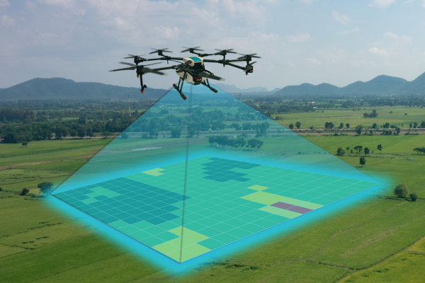
The Municipal Corporation of Delhi (MCD) is preparing to begin a pilot project that will use drones and advanced mapping technologies to strengthen property tax assessment and improve the accuracy of civic records. The initiative, announced in the past week, aims to identify properties that are either outside the property tax net or assessed below their actual value, helping the civic body curb revenue leakages and expand its tax base.
The pilot follows memorandums of understanding (MoUs) signed by the MCD on June 2 with four agencies under its Pilot Drone-based Geospatial Survey and Digital Twin Initiative. Under the programme, each agency will independently undertake surveys using a combination of drone-based aerial imaging, LiDAR mapping, GIS-based asset mapping, digital twin technology, three-dimensional city modelling and advanced data analytics.
Officials said the MCD will not incur any expenditure on the pilot exercise. The independent surveys are intended to evaluate the effectiveness of different technologies and methodologies before the civic body decides whether the programme should be implemented on a larger scale across Delhi.
According to the MCD, the technology will improve the accuracy of property records by identifying unassessed properties as well as properties that may have been assessed below their actual value. The initiative is expected to strengthen tax administration, improve compliance and bring more taxable properties within the municipal system.
Beyond revenue collection, officials said the project is expected to support urban planning by creating a comprehensive geospatial database that can be utilised for civic administration, infrastructure planning and the delivery of municipal services.
The civic body said the pilot will enable it to compare the performance of various survey technologies before selecting the most suitable approach for wider implementation. Subject to the successful completion and evaluation of the pilot projects, the MCD may extend the initiative across its jurisdiction. Officials added that the exercise would also help estimate the approximate number of residential units within areas governed by the civic body.
According to the MCD, the corporation collected around INR 3,116 crore in property tax during 2025–26 from nearly 13,52,500 property taxpayers, although the collection remained below its target of INR 3,500 crore.
Provisional data from the House Listing Operations (HLO) conducted as part of Census 2027 indicate that enumerators recorded 75,98,982 census houses and 54,98,560 households across Delhi's 13 districts. The civic body expects the technology-driven survey to improve property tax compliance, broaden the taxpayer base and support more informed urban governance through accurate geospatial mapping.
Source - PTI
Advertisement













 Facebook
 Whatsapp