Advertisement


Private equity has played a significant role in shaping Indi...
In today’s real estate landscape, fitness is often treated...
In this episode of Prop Personalities, we sit down with Hars...
Luxury real estate is one of the most talked-about segments ...
Welcome to Prop Personalities by Prop News Time - a podcast ...
Ahmedabad-based deeptech firm DrivebuddyAI has secured a patent for its Integrated Dynamic Road Quality Assessment System, designed to detect and map road surface conditions in real time. The technology uses artificial intelligence, sensor data, and computer vision to identify potholes, cracks, and hazardous stretches, generating geo-tagged road intelligence. The system enables fleet operators to incorporate road quality into route planning, beyond traditional parameters such as time and distance. By continuously updating road condition data, the solution aims to improve driver safety, reduce vehicle wear, and enhance logistics efficiency. The development adds to the company's portfolio of over 15 patents in AI-driven mobility and fleet management technologies.
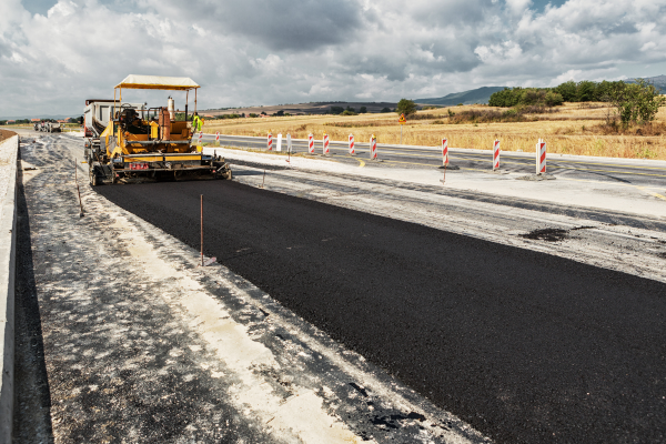
Ahmedabad-based deeptech company DrivebuddyAI has secured a patent in the past week for its Integrated Dynamic Road Quality Assessment System, a technology designed to detect, map, and communicate road surface conditions in real time, with applications across fleet management and highway safety in India. Advertisement


The patented system combines artificial intelligence, sensor-based data capture, and deep learning-driven computer vision to identify road defects such as potholes, cracks, debris, and waterlogging. The platform creates a continuously updated, geo-tagged database of road quality, enabling dynamic mapping rather than relying on static or periodic surveys.
The technology operates using dual data streams. A GNSS sensor tracks vehicle speed and location, while an inertial measurement unit records acceleration changes across multiple axes. When a vehicle encounters irregularities such as potholes, variations in vertical acceleration trigger anomaly detection. This data is then validated using video-based analysis processed through a deep learning model to reduce false positives and confirm the presence of road defects.
Once validated, the system geo-tags and uploads the information to a centralised platform, creating a real-time road intelligence layer. This allows fleet operators and drivers to receive alerts and make route decisions based not only on distance or travel time but also on road surface conditions. The approach addresses a limitation in conventional navigation systems, which typically do not account for road quality in route optimisation.
Company representatives indicated that the technology is intended to improve multiple operational parameters simultaneously, including driver safety, cargo protection, and vehicle maintenance. Poor road conditions often lead to higher braking frequency, increased wear and tear on vehicle components, and potential delays in logistics operations. By incorporating road quality data into route planning, operators can select routes that are more efficient in practice, even if they are not the shortest by distance.
The system also enables communication of road condition alerts through various interfaces, including visual and audio notifications, which can be integrated into fleet management platforms or vehicle systems. Additionally, historical and real-time data collected through the platform can support infrastructure monitoring and maintenance planning by relevant authorities.
DrivebuddyAI has indicated that its artificial intelligence models have been trained on extensive datasets derived from large-scale road usage, allowing the system to adapt to varied Indian road conditions. The patent further strengthens the company's intellectual property portfolio, which includes more than 15 patents across areas such as driver monitoring systems, computer vision, and AI-based risk assessment technologies.
The development reflects the growing role of data-driven technologies in transport and infrastructure management, particularly as road networks expand and logistics operations become increasingly complex. Real-time road condition assessment systems are emerging as a tool to bridge the gap between infrastructure quality and operational efficiency in both public and private mobility networks.

5th Jun, 2025

25th May, 2023

11th May, 2023

27th Apr, 2023
Advertisement


 Facebook
 Whatsapp